Drone to fly from 43km away control room… "From 50m up to find missing child”
Jong Ye-rin | yeslin@ | 2018-05-25 11:26:27

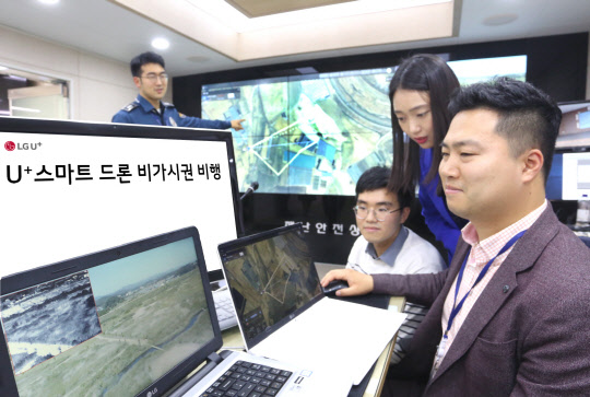
LG U Plus has demonstrated its ability to search for lost children through remote control of real-time drones in Songpa-gu Office, Songpa Police Station and Yeoju Police Station. Photo by LG U Plus
[Digital Times, Jong Ye-rin] Once it hit the start of the flight, the drone, which is located near the Miro Park in Yeoju City, about 43 km away, flies. The drones, climbing up to 50m above the ground, started operations along the pre-entered routes. Within five minutes of the drones` operation, the onboard camera blinked a red box around the missing person on the control screen connected to the 4th generation LTE network.
In the disaster safety situation room of Songpa-gu Office in Seoul on May 23, `Find missing child` using LG U Plus cloud drone control system was conducted. The demonstration was conducted as LGU Plus acquired Hanwha Precision Machinery as the first Korean to acquire special flight status for drones.
LG U Plus will be able to operate the drone at remote or control room without sending people to the site with this qualification.
The drones that operated through the cloud control system used LG U Plus` LTE network to provide stable flight. This system allows you to set flight points with a click on the map before flight. You can also enter the height and speed for each point. On the day of the demonstration, Gangdong-gu Songpa police officer saved the map that the set value was input and prepared the operation, and the route to the drone in Yeoju was delivered through LTE network. The drones stood at a distance of 30 to 50 meters above sea level. The drones, which moved at a speed of 6m / sec, accelerated to a maximum of 10o.
Thermal camera screens, flight path screens, and flight images of drones taken by mobile phones in addition to the images taken with the camera attached to the control room, were transmitted in real time via the LTE network. An official of LG U Plus said, "We can grasp the situation more quickly through detailed screen." The drone who found Mia zoomed in on the mounted camera and marked it in red. The camera can be magnified up to 30 times so that the face of the missing person can be identified. For dark or bad weather, use an infrared camera. The police, who took over the coordinates, quickly arrived at the scene. The drones who complete the mission return to their original position by finding the shortest distance using the "return to home" function. Kang said, "Usually, police officers are on the scene for about five minutes, but it will be possible to shorten the time more quickly by using the drone control system." We would like to be able to supplement the system to respond immediately to the situation "We made an impression of operation.”
Meanwhile, LG U Plus plans to further upgrade its drones. Especially, the station will be used as a settlement and charging station for drone. It will also develop its own maps to improve the accuracy of maps. We are currently using Google Maps. In addition, 5G mobile communication (5G) and artificial intelligence (AI) will be combined to increase safety and accuracy.
Ahn Jae-seong, chief of the Safety Planning Team at Songpa-gu, stated, "In order to prevent safety accidents, employees and residents will be able to check their drones through non-visual inspection in order to improve their efficiency."
Kwon Yong-hoon, head of LG Uplus Dron, said, "We have been able to search quickly and extensively in the event of missing persons through flight of non-visable drones. We plan to consider ways to use synergies by using drone in various environments.”
By Jong Ye-rin yeslin@
